Search from the table of contents of 2.5 million books
Advanced Search (Beta)
Home > western pilot: containing charts of the Ohio River and of the Mississippi,from the mouth of the Missouri to the Gulf of Mexico; accompanied with directions for navigating the same,and a gazetteer; or description of the towns on their banks,tributary streams,etc. ,also a variety of matter interesting to travelers,and all concerned in the navigation of those rivers; with a table of distances from town to town on all the above rivers

western pilot: containing charts of the Ohio River and of the Mississippi,from the mouth of the Missouri to the Gulf of Mexico; accompanied with directions for navigating the same,and a gazetteer; or description of the towns on their banks,tributary streams,etc. ,also a variety of matter interesting to travelers,and all concerned in the navigation of those rivers; with a table of distances from town to town on all the above rivers


Book Informaton
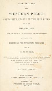
western pilot: containing charts of the Ohio River and of the Mississippi,from the mouth of the Missouri to the Gulf of Mexico; accompanied with directions for navigating the same,and a gazetteer; or description of the towns on their banks,tributary streams,etc. ,also a variety of matter interesting to travelers,and all concerned in the navigation of those rivers; with a table of distances from town to town on all the above rivers

Author

Samuel Cumings

Edition

Rev. and cor. by Capt. Charles Ross & Geo. Conclin.

Year of Publication

1840

Publisher

George Conclin

City of Publication

Cincinnati

Pages

144

Language

en

ARI Id

1672680782065


Find on

World Cat

OpenLibrary

Internet Archive


This page has been accessed 1 times.
Asian Research Index Whatsapp Chanel

Join our Whatsapp Channel to get regular updates.

Access Options
Citation Options
Download Citation


Table of Contents (one per line)*
Helping tools to edit table of contents and see preview

FIND | FIND/REPLACE | REPLACE ALL